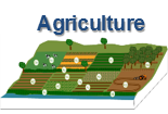
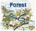
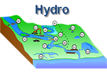
NWRM cover a wide range of actions and land use types. Many different measures can act as NWRM, by encouraging the retention of water within a catchment and, through that, enhancing the natural functioning of the catchment. The catalogue of measures hereunder is sorted by sector. It has been developed in the NWRM project, represents a comprehensive but non prescriptive wide range of measures, and you may have other measures, or similar measures that you call by a different name, that could also be classified as NWRM. When implementing one or more of these measures, it is always necessary to check they can qualify as NWRM according the definition. You can also access the illustrated catalogue in pdf) that includes solely the definition and some illustrations for each NWRM: All NWRM Illustrated.
| Sector | Id Sort ascending | Title |
|---|---|---|
| Urban | U12 | Infiltration basins |
| Urban | U11 | Retention Ponds |
| Urban | U10 | Detention Basins |
| Urban | U09 | Rain Gardens |
| Urban | U08 | Infiltration Trenches |
| Urban | U07 | Soakaways |
| Urban | U06 | Filter Strips |
| Urban | U05 | Channels and rills |
| Urban | U04 | Swales |
| Urban | U03 | Permeable surfaces |
| Urban | U02 | Rainwater Harvesting |
| Urban | U01 | Green Roofs |
| Sector | Id Sort ascending | Title |
|---|---|---|
| Hydro Morphology | N14 | Re-naturalisation of polder areas |
| Hydro Morphology | N13 | Restoration of natural infiltration to groundwater |
| Hydro Morphology | N12 | Lake restoration |
| Hydro Morphology | N11 | Elimination of riverbank protection |
| Hydro Morphology | N10 | Natural bank stabilisation |
| Hydro Morphology | N09 | Removal of dams and other longitudinal barriers |
| Hydro Morphology | N08 | Riverbed material renaturalization |
| Hydro Morphology | N07 | Reconnection of oxbow lakes and similar features |
| Hydro Morphology | N06 | Restoration and reconnection of seasonal streams |
| Hydro Morphology | N05 | Stream bed re-naturalization |
| Hydro Morphology | N04 | Re-meandering |
| Hydro Morphology | N03 | Floodplain restoration and management |
| Hydro Morphology | N02 | Wetland restoration and management |
| Hydro Morphology | N01 | Basins and ponds |
| Sector | Id Sort ascending | Title |
|---|---|---|
| Forest | F14 | Overland flow areas in peatland forests |
| Forest | F13 | Peak flow control structures |
| Forest | F12 | Trees in Urban areas |
| Forest | F11 | Urban forest parks |
| Forest | F10 | Coarse woody debris |
| Forest | F09 | Sediment capture ponds |
| Forest | F08 | Appropriate design of roads and stream crossings |
| Forest | F07 | 'Water sensitive' driving |
| Forest | F06 | Continuous cover forestry |
| Forest | F05 | Land use conversion |
| Forest | F04 | Targeted planting for 'catching' precipitation |
| Forest | F03 | Afforestation of reservoir catchments |
| Forest | F02 | Maintenance of forest cover in headwater areas |
| Forest | F01 | Forest riparian buffers |
| Sector | Id Sort ascending | Title |
|---|---|---|
| Agriculture | A14 | Controlled Drainage |
| Agriculture | A13 | Mulching |
| Agriculture | A12 | Reduced stocking density |
| Agriculture | A11 | Controlled traffic farming |
| Agriculture | A10 | Traditional terracing |
| Agriculture | A09 | Early sowing |
| Agriculture | A08 | Green cover |
| Agriculture | A07 | Low till agriculture |
| Agriculture | A06 | No till agriculture |
| Agriculture | A05 | Intercropping |
| Agriculture | A04 | Strip cropping along contours |
| Agriculture | A03 | Crop rotation |
| Agriculture | A02 | Buffer strips and hedges |
| Agriculture | A01 | Meadows and pastures |


